Since buying a new drone earlier this year, I have tried to capture interesting views of my new home territory of Austin, Texas. My first attempts were in the early winter, which was great for crisp images of the city as there is very little heat haze in winter! But I took the opportunity in early April to spend an afternoon, evening and then early morning in the city and really put the drone through its paces.
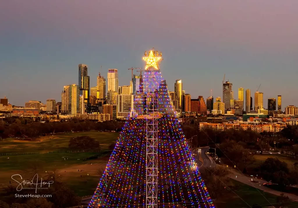
My earliest aerial views of Austin by drone were actually on New Year’s Eve last year! As you can imagine, Zilker park was pretty quiet that evening and the famous Christmas tree lights were still illuminated as the sun lit up the city skyline as it set towards the horizon. It was actually this shot that made me decide to upgrade the drone – it is a perfectly nice image, but my drone only had one relatively wide-angle lens, and a bit like all photographers, I persuaded myself that a drone with three different lenses would give me many more options!
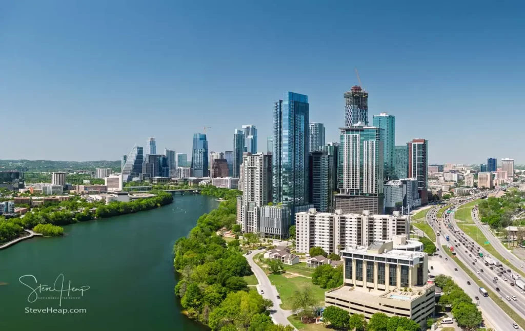
So, with the new drone in hand, I revisited the area in early January to try some different sunset images. Many of these panoramas are actually created with a telephoto lens which gives a magnified view of a small area of the skyline but then I take three rows of 5 images using a rotation of the drone to capture the full scene. Stitching the images together in software allows the full panoramic view to be created with tremendous detail. Some of these images reach 20,000 pixels across – large enough to print on a wall mural if you felt like it!
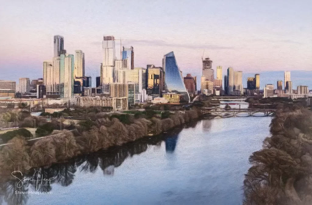
I thought this one would look pretty special as a pastel or crayon type image – digitally created of course!
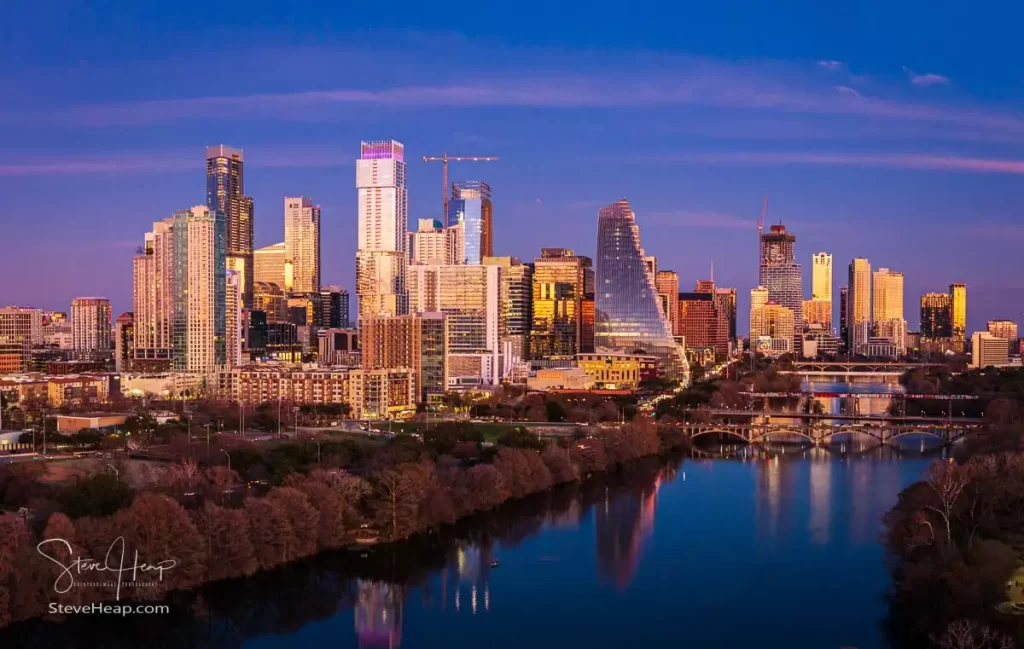
And the final one from that night as the sun continued to set and its final rays illuminated the tall buildings of the city:
So, fast forward to April 2025. I wanted to wait long enough for new leaf growth to be on the trees and for it to be a reasonably windless day. We have had many windy days this spring and while the drone can handle a fair amount of wind, I knew the sunrise images would be pretty dark and would need a long exposure – approaching 1 second perhaps, and so the drone needed to be very steady in the sky to avoid blurring the image.
I decided to try a new view of the city from the east over the I35 bridge over the river. This is just on the edge of the controlled airspace for the airport, and so I applied for permission to fly up to 400 feet for this next viewpoint:
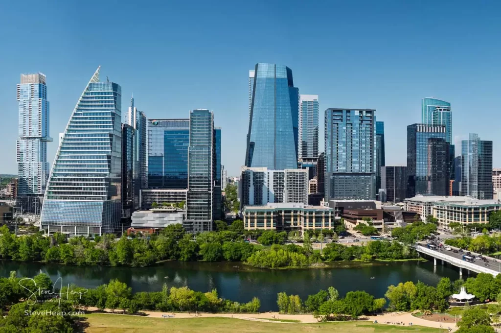
After a quick check-in to my hotel, I decided to head out on foot to do the four-mile walk over the pedestrian bridge, along the waterfront in the Town Park, back across Congress bridge and back to my hotel downtown. Pretty hot and tiring, but it did give me some interesting views from the park of the city buildings:
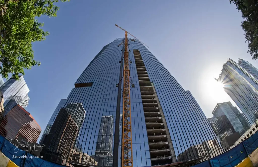
While it isn’t an aerial shot as such, I fitted a fish-eye lens to my main camera during my walk back through downtown to capture this view of the Republic building that is still under construction.
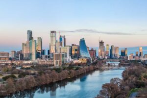
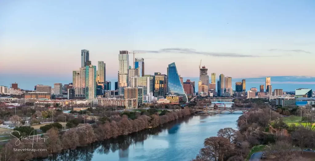
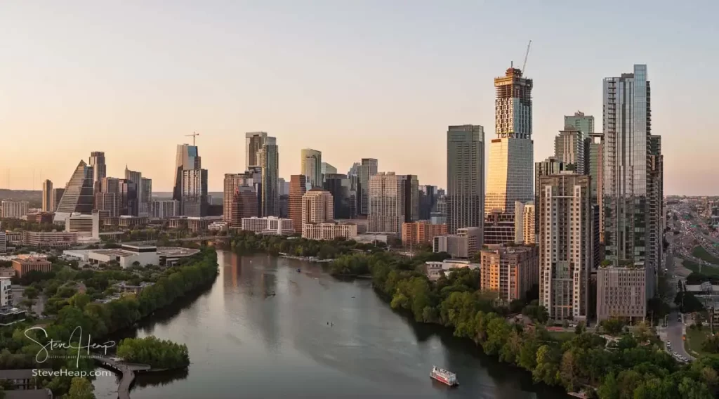
Around 7pm I set out by car this time back to the riverbank by the I35 for a sunset image. There were no clouds that normally add a lot of drama to a sunset, but the warm soft colors made a lovely image of the skyline from the East:
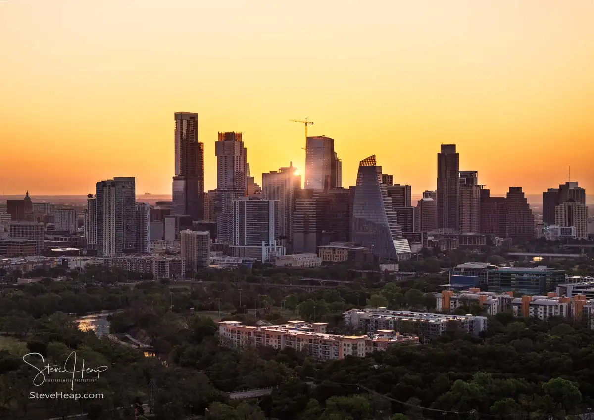
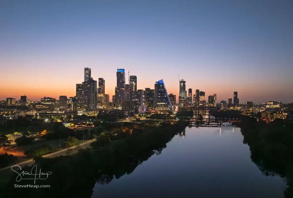
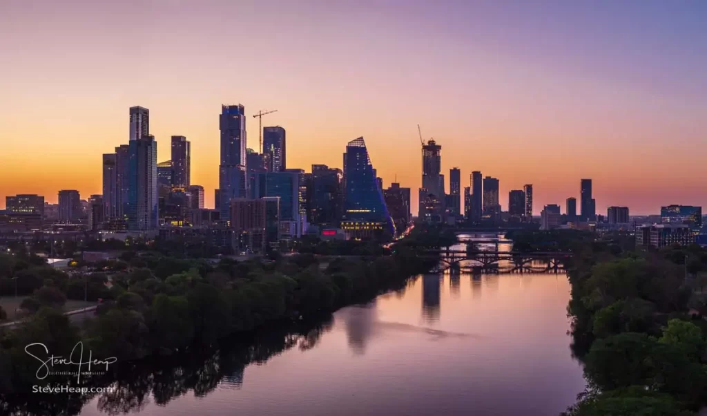
It was close to 8pm now and I was hungry and so the drone was packed away ready for an early start the next morning. And it was early – I was in position in Zilker park again at around 6:20am – almost completely dark at that time, but the drone still did its stuff and flew up and over the river to capture this almost nighttime view of the skyline:
And then finally a much more colorful view just before the sun made its appearance between two of these towers.
I’m sure I will be out and about again soon with the drone – I would really like to see more clouds being illuminated from below by the sun, but it is hard to judge how the sunset will develop when it takes an hour to drive there to capture it – but I will certainly try!